A 7.6 earthquake struck the Caribbean near the Cayman Islands, prompting evacuations and tsunami warnings for Puerto Rico.
A 7.6 magnitude earthquake has rocked the Caribbean, leaving communities across the region on high alert and prompting widespread concern about potential tsunami waves. This seismic event, which struck on Saturday evening, is a stark reminder of the region’s vulnerability to tectonic activity. Here’s what we know so far about the quake, its impact on affected areas, and the measures being taken to ensure public safety.
Earthquake Details
The powerful earthquake occurred at 6:23 p.m. local time (23:23 UTC) on Saturday, with its epicenter located approximately 130 miles (209 kilometers) south-southwest of George Town in the Cayman Islands, according to the U.S. Geological Survey (USGS). The quake registered at a shallow depth of 10 kilometers (6.2 miles), amplifying its intensity and potential for damage.
While the initial tremor was widespread, reports of significant aftershocks have yet to emerge, though experts are closely monitoring for any further seismic activity. The USGS indicated that this earthquake reflects the ongoing tectonic dynamics of the Caribbean Plate, an area prone to seismic activity due to converging fault lines.
Impact on Affected Areas
Cayman Islands
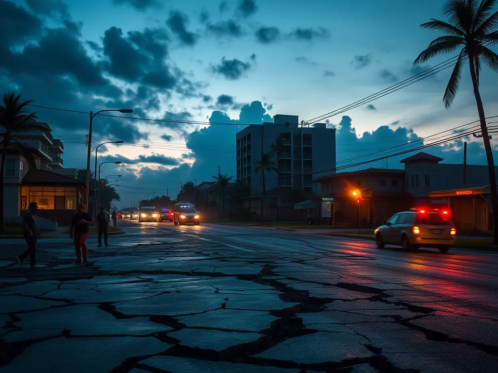
The Cayman Islands were among the hardest hit. Residents of Grand Cayman reported feeling strong tremors that rattled buildings and caused structural damage in some areas. Initial surveys reported:
- Power outages across several neighborhoods.
- Cracks in key roadways, disrupting transportation.
- Emergency teams responding to assess the full extent of damages.
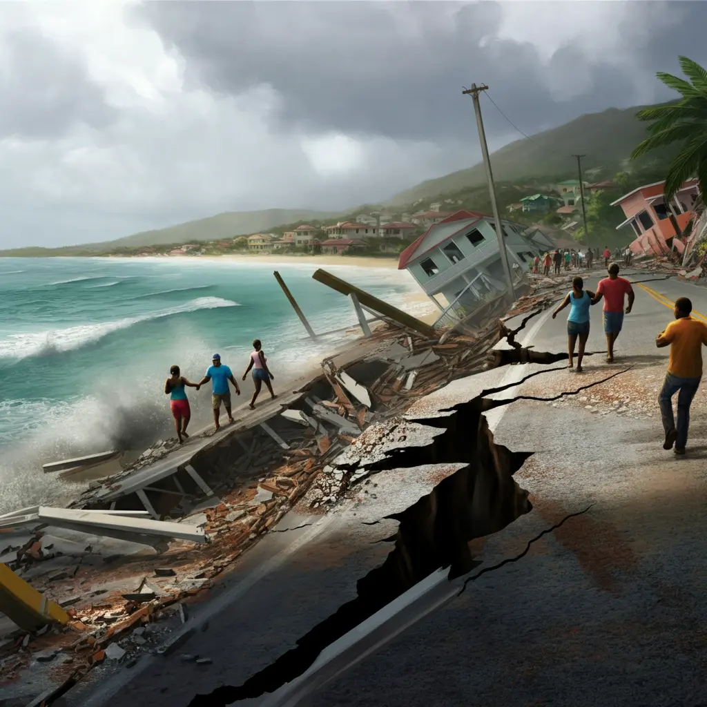
Hazard Management Cayman Islands advised all residents near the coast to evacuate to higher ground following tsunami warnings. Waves of 0.3 to 1 meter were expected to impact coastal areas, though the advisory was later scaled down as activity subsided.
Puerto Rico
Following the quake, Puerto Rico was placed under a tsunami advisory, which sparked scenes of unease. Coastal areas experienced significant evacuations, particularly in the northwest region, where alarms were sounded. Crowds of people attempting to head inland led to heavy traffic and congestion on key roads.
Although Gov. Jenniffer González Colón assured residents that there was no immediate need to leave the coast, many took warnings seriously and moved to higher ground as a precaution.
Honduras and Belize
Both Honduras and Belize experienced tremors, though the extent of the damage was more limited compared to territories closer to the epicenter. Honduran authorities reported no immediate injuries or structural damage, but residents were urged to stay away from beaches as a precautionary measure.
Cuba, the Dominican Republic, and The Bahamas
Governments in Cuba, the Dominican Republic, and The Bahamas issued their own tsunami alerts, advising those in beachfront areas to move to higher ground. Later assessments downgraded the risk, and most advisories were canceled.
Tsunami Warning & Precautions
The Pacific Tsunami Warning Center (PTWC) was quick to issue alerts following the earthquake. Areas highlighted in the warning included:
- Puerto Rico
- The Cayman Islands
- U.S. Virgin Islands
- Coastal areas of Cuba and The Bahamas
For parts of Cuba, authorities warned of potential tsunami waves reaching 1 to 3 meters above normal tide levels. Other regions, including Honduras and Belize, were asked to remain vigilant and stay away from coastal areas for safety.
Emergency protocols quickly activated in affected areas included:
- Restrictions on coastal activity.
- Evacuation orders for residents in at-risk zones.
- Public safety alerts disseminated via social media, alerts, and radio.
While initial fears of widespread tsunami damage have subsided, caution remains paramount as coastlines continue to experience elevated wave levels.
Expert Opinions & Historical Context
What Do Experts Say?
Seismologists from the USGS and other research centers point to the active tectonics of the Caribbean Plate, which frequently experiences seismic activity. Shallow quakes with magnitudes exceeding 7.0 can cause extensive damage and are often accompanied by tsunami warnings.
A History of Seismic Activity
This earthquake is one of many to strike the region in recent history:
- A 7.7 magnitude earthquake occurred in 2020 near the Cayman Islands and Jamaica, also prompting tsunami warnings.
- In 2010, a devastating 7.0 magnitude earthquake struck Haiti, resulting in catastrophic loss of life and infrastructure damage.
Geologists emphasize the need for improved disaster preparedness, particularly for nations and territories located along fault lines.
Government Response & Future Preparedness
Immediate Actions
Governments across affected regions were swift in enacting evacuation plans and monitoring coastal activities. Emergency services were dispatched to assess structural damage and provide relief to those in need. While no widespread injuries or fatalities have been reported, ongoing assessments will reveal the full scope of the impact over the coming days.
Building for the Future
This event underscores the vital importance of disaster preparedness in regions prone to earthquakes and tsunamis:
- Governments must continue to invest in warning systems, such as those provided by the other states.
Learn more about how AI images are changing the world as they redefine creativity and aesthetics across various platforms. This technological innovation has not only influenced professional artists but also empowered amateurs to express themselves visually with remarkable ease. The rise of AI-generated images is altering the dynamics of social media, most notably on platforms like Instagram, where users are increasingly captivated by the vibrant and intricate designs produced by artificial intelligence. To dive deeper into this fascinating topic, click here.